This article has multiple issues. Please help improve it or discuss these issues on the talk page. (Learn how and when to remove these messages)
|

The Chilean Maritime Domain (Spanish: Espacio marítimo chileno), also known as the Chilean Sea (Spanish: Mar Chileno), comprises the set of maritime spaces over which Chile exercises sovereignty, exclusive rights, and claims of varying degrees in the Pacific, Atlantic, and Southern Oceans. This definition often includes the adjacent high seas area known as the “presential sea,” over which Chile neither exercises nor claims any degree of sovereignty. Additionally, Chile claims sovereignty over its continental shelf and extended continental shelf.
It is not strictly a sea in the geographic sense defined by the International Hydrographic Organization, but rather a sea in a legal and political sense. It refers to the waters surrounding the continental coast up to 200 nautical miles to the west from the low tide line, and in the case of the Polynesian islands of Rapa Nui (Easter Island) and Salas y Gómez, 350 nautical miles. Through Decree 346 of 1974 by the Ministry of Foreign Affairs, this area was designated as the "Chilean Sea" (Mar Chileno).[1]
Law 18,565 of 1986 amended various legal norms to align Chile’s legal framework with the United Nations Convention on the Law of the Sea (UNCLOS),[2] and through Law 19,080 of 1991, the "Chilean presential sea" (mar presencial) was defined unilaterally.[3]
Regarding the northern limit, Peru raised a dispute, which was resolved on January 27, 2014, by a ruling from the International Court of Justice that partially established a new maritime border.[4][5] The exact coordinates of this new boundary were determined on March 25 of the same year through the signing of an agreement between the two states at the Peruvian Ministry of Foreign Affairs.[6] Additionally, as a result of the establishment of the new maritime boundary, this ruling led to a reduction of Chile’s maritime zone by granting Peru a portion of it.[7]
In 2021, Chilean President Sebastián Piñera signed Supreme Decree No. 95, which explicitly defined the continental shelf east of meridian 67° 16' 0" as part of Chile’s (non-extended) continental shelf area, projected from the Diego Ramírez Islands. This also laid claim to the crescent-shaped area that Argentina considers part of the extension it obtained under the criteria for an extended continental shelf.[8][9][10] This was reflected in SHOA Chart No. 8[11] and prompted a response from Argentina’s Ministry of Foreign Affairs opposing Chile’s measure within the framework of the dispute over the extended continental shelf in the Southern Zone Sea between Argentina and Chile.[12][13][14]
On December 21, 2020, Chile submitted to the United Nations Commission on the Limits of the Continental Shelf a partial report regarding the extended continental shelf around Easter Island and Salas y Gómez Island.[15][16]
In February 2022, Chile submitted its second partial presentation concerning the Western Continental Shelf of the Chilean Antarctic Territory.[17][18] In August of the same year, it delivered the oral presentations for both partial submissions during the 55th Session of the Commission on the Limits of the Continental Shelf at the United Nations in New York.[19][20]
In 2023, Chile, through SHOA, made available an illustrative graphic showing all maritime areas claimed by the country; this was once again rejected by Argentina.[21][22][23][24]
The Chilean Sea contains significant amounts of phosphorite and manganese-iron nodules, which may be potential targets for future seafloor mining.[25]
Continental shelf and extended continental shelf
editThe continental shelf of Chile is the underwater extension adjacent to the Chilean coasts that stretches from the shoreline to the edge of the continental shelf in the Pacific Ocean and the Southern Ocean.[26][27]
The scientific study and delimitation of the continental shelf and its outer limit are conducted by the National Committee for the Continental Shelf, established in 2007.[28][29]
The delimitation of Chile's continental shelf follows principles established by the United Nations Convention on the Law of the Sea (UNCLOS), which sets guidelines for the delineation of continental shelves by coastal states. Chile has submitted claims to the United Nations Commission on the Limits of the Continental Shelf.
Apart from its economic importance, the continental shelf also holds geopolitical significance. Its delimitation has occasionally led to tensions with neighboring countries, particularly Argentina, which also claims rights over adjacent maritime areas.[30][31][32][33][34] Decisions and presentations made to the UN have influenced bilateral relations and Chile's maritime policies, making the continental shelf a critical issue in the country's security and defense agenda.
Presential sea
edit
The face sea, or heritage safeguard sea, is the maritime space that a certain coastal country demarcates, after an oceanopolitical appreciation, in order to indicate to third parties its zone of influence in the high seas adjacent to its exclusive economic zone, where its interests were or could be directly involved.
Without claims of sovereignty, by making a delimitation that includes the effective occupation of the high seas contiguous to its respective oceanic territory, the coastal state shows the interest in preserving said area from abusive uses or from certain activities that, due to its proximity, may affect the marine resources that inhabit its waters, especially, guarding the highly migratory straddling fishery resources from predation, and pollution of the marine habitat.
EEZ of Chile
edit
Chile's EEZ includes areas around the Desventuradas Islands, Easter Island and the Juan Fernández Islands.
| Region | EEZ Area (km2)[35] | Land area | Total |
|---|---|---|---|
| Mainland | 1,975,760 | 755 757 | 2,731,517 |
| Desventuradas | 449 836 | 5 | 449 841 |
| Easter | 720 412 | 164 | 720 576 |
| Juan Fernandez | 502 524 | 100 | 502 624 |
| Total | 3,648,532 | 755 921 | 4,404,453 |
Gallery
edit-
 The Ferdinand Magellan's Nao Replica in the Museo Nao Victoria in Punta Arenas Chile, the first ship to sail it
 -
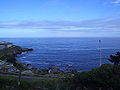 The Chilean Sea
 -

See also
edit- Borde costero
- Maritime history of Chile
- Continental shelf of Chile
- Insular Chile
- Islands of Chile
- Tricontinental Chile
- Chilean Antarctic Territory
- Geography of Chile
- Chilean–Peruvian maritime dispute
- Pacific Islands Forum
- Easter Island
- Exclusive economic zone of Chile
- Presential Sea
- Mar de Grau
- Movimiento Archipiélago Soberano
- Norwegian Sea
- Libyan Sea
- List of active separatist movements in South America
- Chiloé Province
- Patagonia
- Arica y Parinacota Region
- Easter Island
References
edit- ^ Ministry of Foreign Affairs (4 June 1974). "Decreto 346: Denomina Mar Chileno a las aguas del mar que bañan el territorio nacional". Library of the National Congress of Chile (in Spanish). Retrieved 4 March 2026.
- ^ Ministry of Justice (23 October 1986). "Ley 18565: Modifica el Código Civil en materia de espacios marítimos y dicta norma que indica". Library of the National Congress of Chile (in Spanish). Retrieved 4 March 2026.
- ^ Ministry of Economy, Development and Reconstruction (6 September 1991). "Ley 19080: Modifica ley N° 18892, general de pesca y acuicultura". Library of the National Congress of Chile (in Spanish). Retrieved 4 March 2026.
{{cite web}}: CS1 maint: multiple names: authors list (link) - ^ "Judgment Maritime Dispute (Peru v. Chile)" (PDF). International Court of Justice. 27 January 2014. Retrieved 4 March 2026.
- ^ "Maritime Dispute (Peru v. Chile) Summary of the Judgment" (PDF). International Court of Justice. 27 January 2014. Archived from the original (PDF) on 2 February 2014. Retrieved 4 March 2026.
- ^ Andrews, Juan Pablo (26 March 2014). "Chile y Perú firman acuerdo de coordenadas marítimas según el fallo de La Haya". La Tercera (in Spanish). Retrieved 4 March 2026.
- ^ "La agenda que Chile y Perú buscan descongelar en la era Kuczynski". T13 (in Spanish). 28 July 2016. Retrieved 4 March 2026.
- ^ "Piñera: "Lo que Chile está haciendo es ejercer su derecho y declarar su plataforma continental"". T13 (in Spanish). 29 August 2021. Retrieved 4 March 2026.
- ^ Torres, Cristián (16 December 2021). "Chile pedirá a la ONU una extensión de su plataforma marítima que ya genera conflicto con Argentina". Infobae (in Spanish). Retrieved 4 March 2026.
- ^ "Conflicto diplomático entre Argentina y Chile por la Plataforma Continental" (PDF). Ministry of Agriculture (Spain) (in Spanish). 14 September 2021. Retrieved 4 March 2026.
- ^ Ipinza M., Juan Ignacio (3 September 2021). "Campo de Hielo Patagónico Sur y la carta SHOA N° 8". Infogate (in Spanish). Retrieved 4 March 2026.
- ^ "Tras decretos: Argentina acusa a Chile de buscar "apropiarse" de plataforma continental austral". T13 (in Spanish). 28 August 2021. Retrieved 4 March 2026.
- ^ "Argentina reclama a Chile por un área que aún no le pertenece". Revista Puerto (in Spanish). 30 August 2021. Retrieved 4 March 2026.
- ^ Ramírez, N. (2 September 2021). "Canciller Allamand afirma que "le parece inoficioso entrar en mayor debate público" con Argentina por plataforma continental". El Mercurio (in Spanish). Retrieved 4 March 2026.
- ^ "Chile busca delimitar la Plataforma Continental de la provincia de Isla de Pascua". La Prensa Austral (in Spanish). 16 June 2024. Retrieved 4 March 2026.
- ^ Aimone Arredondo, Gustavo (28 February 2021). "La plataforma continental extendida en isla de Pascua y Salas y Gómez". Revista de Marina (in Spanish). Retrieved 4 March 2026.
- ^ Comité Nacional de la Plataforma Continental - Chile (28 February 2022). "Plataforma Continental Occidental del Territorio Chileno Antártico" (PDF). United Nations (in Spanish). Retrieved 4 March 2026.
- ^ García, Nicolás (16 December 2021). "Chile presentará a la ONU la plataforma continental extendida al oeste de la Antártica". Info Defensa (in Spanish). Retrieved 4 March 2026.
- ^ "Chile realiza sus presentaciones orales de Plataforma Continental extendida de Isla de Pascua y Antártica a la Comisión de Límites de la Plataforma Continental en Naciones Unidas". Dirección Nacional de Fronteras y Límites del Estado (DIFROL) (in Spanish). 22 August 2022. Retrieved 4 March 2026.
- ^ "Proyecto Plataforma Continental de Chile". ArcGIS StoryMaps (in Spanish). 15 September 2025. Retrieved 4 March 2026.
- ^ "SHOA pone a disposición gráfico ilustrativo de los espacios marítimos de jurisdicción chilena". Armada de Chile (in Spanish). 23 August 2023. Retrieved 4 March 2026.
- ^ Toro, D.; Ramirez, N. (29 August 2023). "Plataforma continental: La postura que ha mantenido Chile ante los reparos de Argentina y la nueva molestia por mapas del SHOA". El Mercurio (in Spanish). Retrieved 4 March 2026.
- ^ Jara A., Ramon (29 August 2023). "Cancillería argentina envía queja formal a Chile por mapa de la Armada que incluye plataforma continental". El Mercurio (in Spanish). Retrieved 4 March 2026.
- ^ "Argentina protesta por mapa con plataforma continental elaborado por Armada de Chile". Nuevo Poder (in Spanish). 29 August 2023. Retrieved 4 March 2026.
- ^ García, Marcelo; Correa, Jorge; Maksaev, Víctor; Townley, Brian (2020). "Potential mineral resources of the Chilean offshore: an overview" (PDF). Andean Geology. 47 (1): 1–13. doi:10.5027/andgeoV47n1-3260.
- ^ Juan Ignacio Ipinza Mayor (December 2019). "La plataforma continental de Chile en el área del Cabo de Hornos y el Pasaje Drake: Tiempo de definiciones" (PDF). Center for Research and Strategic Studies (in Spanish). 12–2019. ISSN 0719-4110. Retrieved 21 November 2024.
- ^ Jorge Guzmán (2017). "La plataforma continental extendida: el caso de Chile y Argentina en el mar austral y la Antártica". Revista de Marina (in Spanish). 957: 12–17. ISSN 0034-8511.
- ^ "Proyecto Plataforma Continental de Chile". National Committee for the Continental Shelf - Chile (in Spanish). Government of Chile. 2023. Retrieved 21 October 2024.
- ^ "Decreto Nº 164 - Crea Comité Nacional de la Plataforma Continental" (in Spanish). FAO. 3 December 2007. Retrieved 21 November 2024.
- ^ Karen Manzano; Diego Jiménez (2023). "Plataforma continental y la Antártica Chilena: Antecedentes históricos, geopolítica y recursos naturales" (in Spanish). ANEPE. Retrieved 17 October 2024.
- ^ "Plataforma continental extendida en la Antártica y la situación de Chile" (in Spanish). Revista Marina. 17 August 2021. Retrieved 17 October 2024.
- ^ "Plataforma continental argentina: La nueva disputa con Reino Unido y el papel de Chile" (in Spanish). Biobío. 30 March 2016. Retrieved 17 October 2024.
- ^ "La zona en el pasaje de Drake que genera una disputa territorial entre Argentina y Chile" (in Spanish). BBC Mundo. 10 September 2021. Retrieved 17 October 2024.
- ^ "Tensión entre Chile y Argentina por la plataforma continental" (in Spanish). La Tinta. 2 September 2021. Retrieved 17 October 2024.
- ^ See Around Us Project (n.d.). "Exclusive Economic Zones (EEZ)". Retrieved 3 June 2015.
EEZ waters of: Chile 1,975,760 km², Desventuradas Isl. 449,836 km², Easter Isl. 720,412 km², J. Fernandez, Felix and Ambrosio Isl. 502,524 km²
